|
A supplement to the |
|
eBook and website by Cyril J Wood |
A Walk Around the Canal Heritage Features of
Castlefield...
The Bridgewater Canal's Historic Manchester Terminus
|
A supplement to the |
|
eBook and website by Cyril J Wood |
|
|
|
|
Castlefield Canal Heritage Walk
On Saturday the 27th June 2009 I gave a conducted walk around the canal heritage features of Worsley to members of Lymm CC to commemorate the two hundred and fiftieth anniversary of the successful passing of the Act of Parliament allowing the construction of the first part of the Bridgewater Canal from Worsley to Castlefield in Manchester. Almost two years to the day, on Saturday the 2nd July 2011 I gave another conducted walk for members of Lymm CC. This time it was around the canal heritage features of Castlefield to commemorate the two hundred and fiftieth anniversary of the opening of the first part of the Bridgewater Canal from Worsley to Castlefield in Manchester.
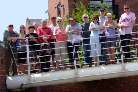
Some of the Lymm CC members on the Castlefield Canal Heritage Walk with yours truly in the centre
(Photograph - Angela Wood)
Pre-Bridgewater Canal Castlefield
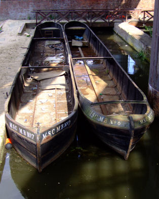
The Castlefield area of Manchester is so called because it was once the location of a Roman settlement (not really a castle but a manor house) known as Mancunium from which the modern name of Manchester is derived. There are restored remains which can be walked around to the south of the Staffordshire Warehouse Arm and Events Arena by Castlefield Junction. The Romans were also responsible for constructing one of the first canals (or, as the Romans called them... "Fosses") in Britain which was built here in A.D.64 to connect the River Irk to the River Irwell, pre-dating the Bridgewater Canal by 1700 years!
The Roman remains at Castlefield of Mancunium from which Manchester's name is derived
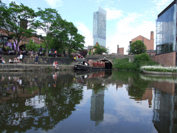
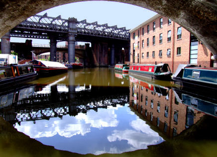
Castlefield and the Bridgewater Canal
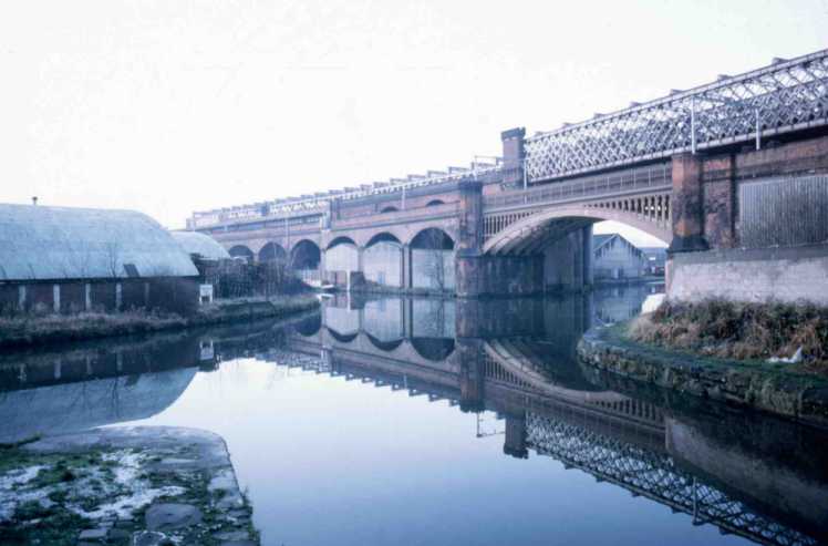
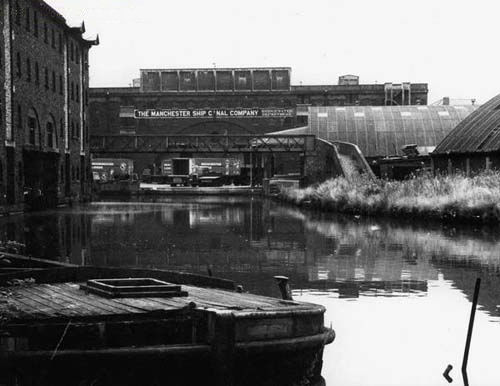
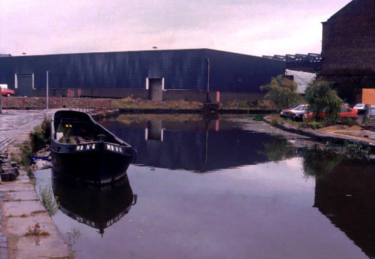
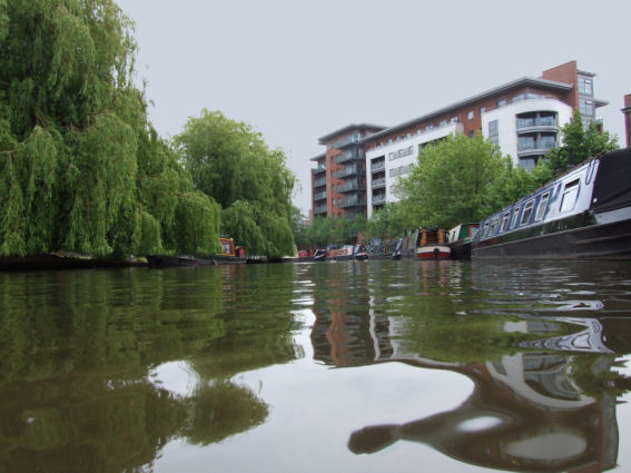
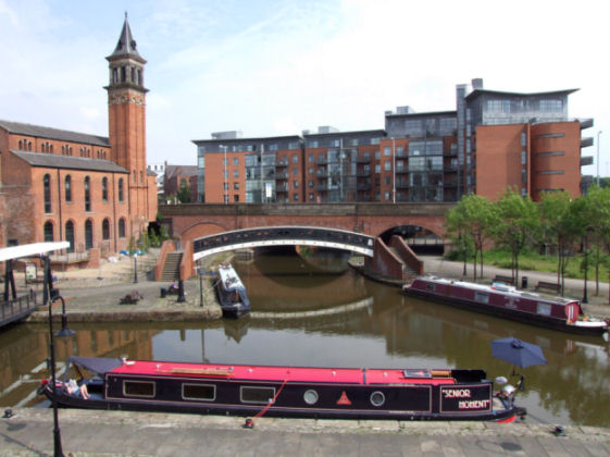
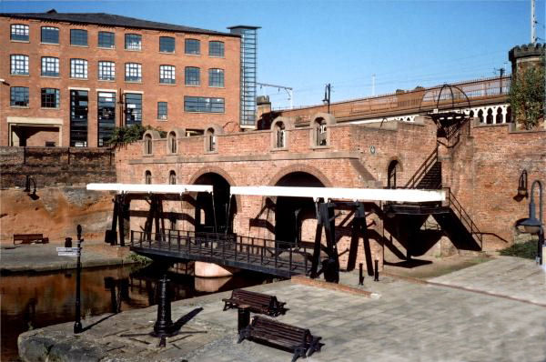
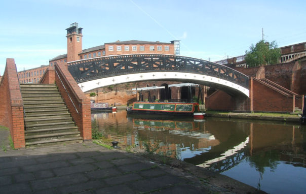
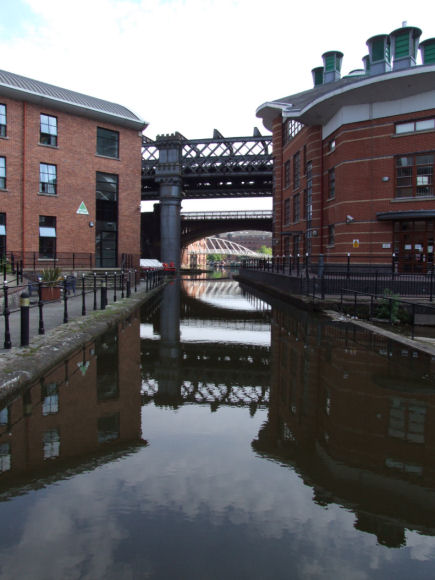
The Bridgewater Canal originally ran from the Duke of Bridgewater’s mines at Worsley to a basin complex in Manchester established in 1761. This terminus area was called Castlefield due to being close to the remains of the previously mentioned Roman settlement. When the Rochdale Canal reached Manchester in 1800 a junction with the Bridgewater Canal was formed adjacent to the wharves and terminus close to Deansgate. In the canal’s commercial heyday the wharves were surrounded not only by warehouses but by industry with many factories located next to the canal for easy access to the canal system. Since 1988 the area has been redeveloped, old buildings demolished, new ones constructed and others converted into residential or leisure amenities. New bridges such as the futuristic Merchant's Footbridge and Grocer's Footbridge also add to the area.
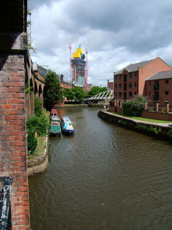
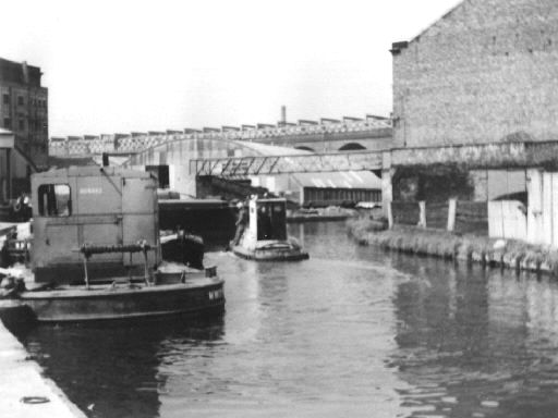
The approach to Castlefield Junction in 2005 when there was a breach that lowered water levels with Beetham Tower under construction in the distance...
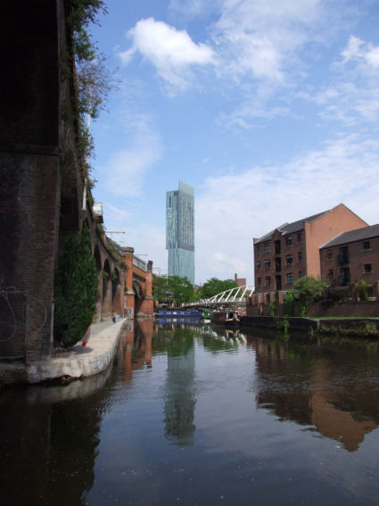
... and the same location in 2010 with a completed Beetham Tower overlooking the area
Castlefield Junction in 1987
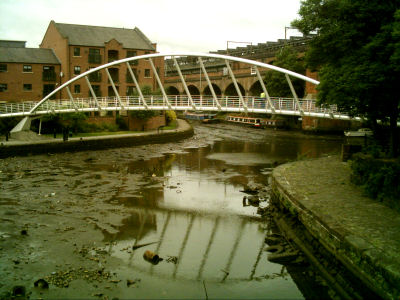
The futuristic Merchant's Footbridge spanning a drained Bridgewater Canal in 2005
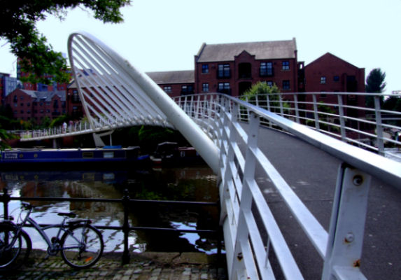
Merchant's Footbridge seen from another viewpoint
Merchant’s Warehouse
Castlefield Junction and a roofless Merchant's Warehouse on the right in 1986 prior to restoration...
... and the restored Merchant's Warehouse in 2011
This substantially built warehouse was one of the earliest remaining warehouses in the area which was built in the 1820s and once featured two under-cover loading and unloading docks. It fell into disrepair during the 1950s and 1960s and was not much more than an empty shell with part of its roof missing until it was restored during 1988. After restoration it was home to a firm of IT consultants who have now left and currently stands empty awaiting new tenants.
Jackson's Wharf
Opposite the Merchant's Warehouse is an area known as Jackson's Wharf. Historically a slate wharf in more recent times it was a road transport warehouse. After regeneration the Jackson's Wharf public house occupied the site until it closed and later refurbished to open in July 2012 at "The Wharf" public house. If you go into The Wharf you will notice that there are many old photographs on the wall. If some of those photographs look familiar it is not surprising as I was approached by the manager to supply photographs of the area, many of which are contained within this section of the Canalscape website.
Jackson's Wharf in 1972
"Dukers" being unloaded at Jackson's Wharf in the 1950s
Jackson's Wharf prior to regeneration...
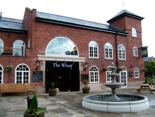
... and in 2012 with "The Wharf" public house occupying the location
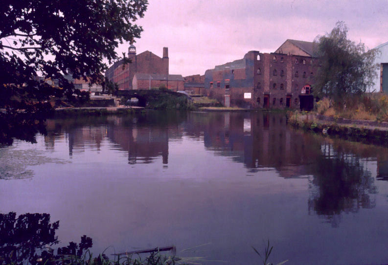
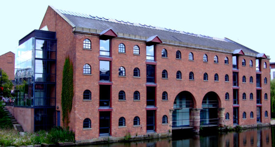
Middle Warehouse
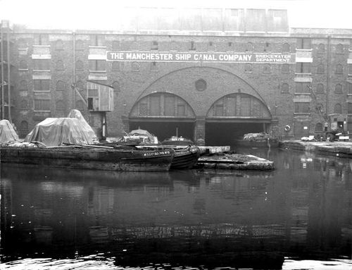
Middle Warehouse in the 1930s
Duke's Dock Warehouse in Liverpool
Like Merchant’s Warehouse, the Middle Warehouse was built in the late 1820s and also had two under-cover loading and unloading docks. The basin in front of the warehouse was known as Middle Basin and was in-filled during the 1950s. The warehouse was restored during the late 1980s and the basin was opened-up with a new lift bridge spanning the entrance. It is now home to Magic FM and Key 103 Radio Stations, a bar and the upper floors have been made into apartments. It once had a twin in Liverpool situated in the Duke’s Dock next to the Albert Dock.
Middle Warehouse and Basin in 2010
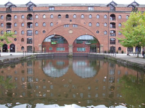
Castle Quay
Two photographs of Castle Quay... the first in the 1950s and the second in 1987
Another 1987 view of Castle Quay looking towards Deansgate with restoration just under way
Castle Quay as it is today
Looking down Castle Quay in 1985 lined with parked cars...
... and still a car park in 1987
The restored Castle Quay drained in 2005 after the breach...
... and back to normal in 2007
The new Grocer's Footbridge with Grocer's Warehouse on the left in 2010
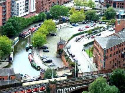
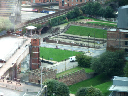
A 2010 aerial photograph of Castle Quay from Beetham Tower
River Medlock and Siphon Tunnel
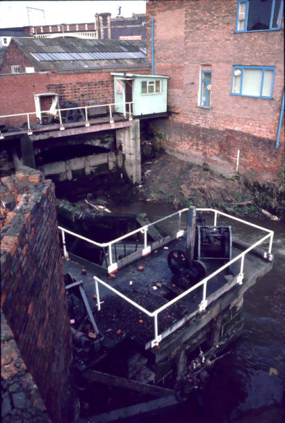
River Medlock Siphon Tunnel Entrance
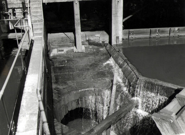
A close-up view of the River Medlock Siphon Tunnel entrance
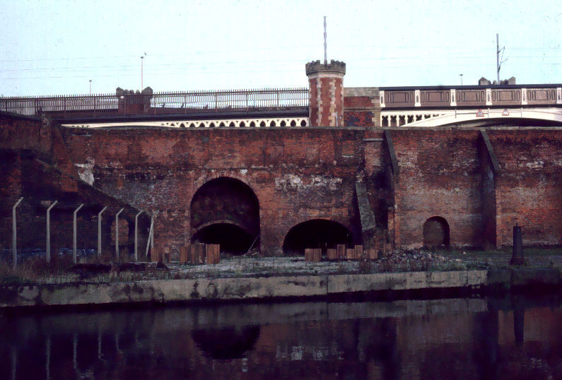
The line of the canal at Castlefield was once the route of the River Medlock as it wound its way through the area to join the River Irwell adjacent to what is today Hulme Lock. When the canal was constructed James Brindley utilised the route of the river for the line of the canal and the river as a major source of water for the canal. He built a siphon and tunnel to take the river beneath the canal and the wharf areas. Before the Old Basin at the end of the canal adjacent to Knott Mill Bridge was truncated small Bridgewater boats could travel along the River Medlock for a short distance delivering coal to factories in the vicinity and into the Duke's Tunnel close to the old Garrett Dye Works. This tunnel was completed in 1789 and was 650 yards in length, 8ft 6ins high and 6 feet wide. Judging by the narrow width and lack of towpath the boats used must have been "Starvationers"... the type of compartment boat used inside the Worsley Mines. At the coal face the coal they carried was loaded into wooden containers which fitted in between the exposed ribs inside the boats (hence the name "Starvationers"). The boats were "legged" through the tunnel and the coal delivered to the end at Bank Top close to the approach to Piccadilly Station. Once at the end of the tunnel, near the junction of London Road and Ducie Street, the wooden coal containers were winched to the surface by a horse gin... a horse-powered hoist for delivery to the adjacent Knowles and Sons Coal Yard. The River Medlock was gradually made un-navigable by about 1800 due to adjacent factories and mills disposing of cinders and other rubbish into it causing it to silt up.
Entrance to the Duke's Tunnel off the River Medlock upstream from Castlefield
The end of the Castle Quay and the location of the Old Basin with the River Medlock beyond the buildings
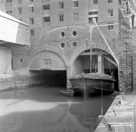
Grocer’s Warehouse and Tunnel
Grocer's Warehouse in 1985 prior to partial reconstruction...
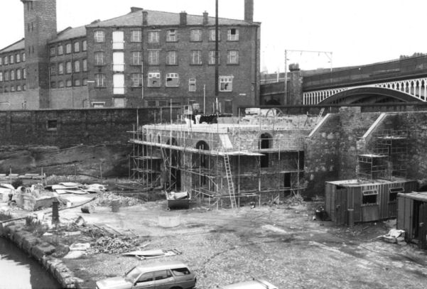
... in 1987 during partial reconstruction...
... and as it is today complete with two new bascule bridges spanning the reinstated canal entrance
Close to the southern end of Castle Quay is a short arm off the canal leading to Grocer's Warehouse. As with the Merchant's and Middle Warehouses it was built in the late 1820s and featured two entrance arches leading to undercover loading docks. Once inside the warehouse, cargo from boats was hoisted using a winch powered by a large waterwheel located in a subterranean chamber and turned by the River Medlock. The chamber is still in existence and water can be heard running through it. A replica waterwheel has been reconstructed to power the original winching gear and demonstrations on how the winch operated are given periodically. The original warehouse building was demolished in 1960 but was partially reconstructed in 1987 complete with two bascule bridges spanning the reinstated entrance arms.
The new footbridge installed in 2002 with Grocer's Warehouse beyond
Beyond the loading docks inside the warehouse was the entrance to a tunnel known as the Bridgewater Tunnel. This tunnel ran for 620 yards (600 mtrs) from the warehouse entrance through the solid sandstone escarpment as far as Bank Top with shaft connections to coal yards along its length. The tunnel was truncated and sealed-up when the Rochdale Canal was constructed in 1800. In 2007 parts of it came to light when land between Bridgewater Street and Liverpool Road was being redeveloped.
Location of a winch shaft between Bridgewater Street and Liverpool Road
(Photograph - Paul J Sillitoe)
Pioneer Wharf

Pioneer Wharf and the remains of the Bridgewater Tunnel
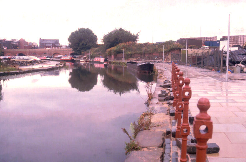
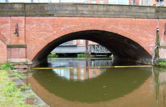
Pioneer Wharf on the Rochdale Canal adjacent to Deansgate Tunnel was once owned by the Rochdale Co-operative Society (Rochdale’s being the first Co-operative Society in the country hence the name “Pioneer”). To the left of the wharf can be seen the remains of the Bridgewater Tunnel on its way from Grocer’s Warehouse. The tunnel was dissected when the canal was constructed in 1800. It is low down in the water due to the water level on the Rochdale Canal being higher than the level of the Bridgewater Canal because of the canal being raised by Lock 92 at Castlefield Junction... the first lock (of 92) on the Rochdale Canal.
Bridge detail on the Rochdale Canal opposite Pioneer Wharf
The drained Rochdale Canal in 1985 with Pioneer Wharf and the remains of the Bridgewater Tunnel on the right...
... and a later 1988 photograph with the canal in water
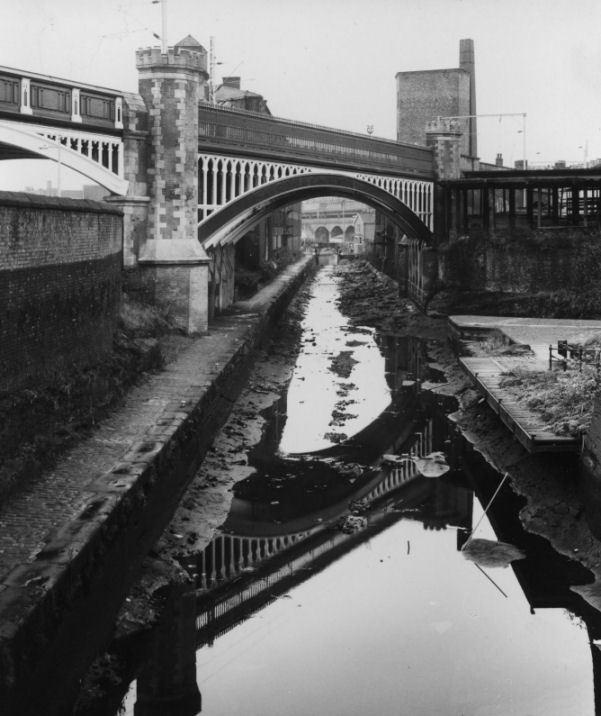
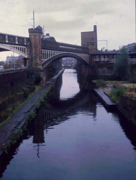
Castlefield Junction and the River Medlock Tunnel Vent
Castlefield Junction
At Castlefield Junction the Rochdale Canal starts its journey to the town that gives it its name. The first lock is Lock 92… a clue as to how many locks there are on this canal! The River Medlock has been flowing in its subterranean tunnel beneath the wharves, warehouses and the canal from the end of Castle Quay. Adjacent to the junction can be seen a breather vent for the tunnel and the river can be heard running at the bottom of it.
The River Medlock Tunnel's vent with the entrance to the Rochdale Canal in the background
The Kenworthy Warehouse and Staffordshire Warehouse Arms and the Events Arena
The two wharves in the area to the north of the Roman Remains were once know as the Staffordshire Warehouse Arms. Off the entrance basin id the old Kenworthy Warehouse Arm used by the Bridgewater Canal Company for work boat storage. This arm is also known as "Cropper's Corner" due to the Coronation Street character Roy Cropper being thrown into the canal in an attempt to drown him by Underworld proprietor Tony Gordon. In the Staffordshire Warehouse Arms; now the warehouse has gone the area forms a natural amphitheatre. When the area was renovated this feature was utilised to become an events arena for live music events, outdoor theatre, a large screen TV for the 2010 World Cup football matches and in 2011 was one of the locations used for the Red or Black game show hosted by Ant and Dec. The area also features as a location for many Manchester based television programmes including the previously mentioned Granada TV's "Coronation Street". In 2005 a run-off sluice failed on the peninsular between the Staffordshire Arms and Giant's Wharf. This breach caused the canal to drain as far as Sale and the Trafford Centre and lowered water levels as far as Preston Brook, Runcorn and Wigan. Some of the photographs above show the canal just after the breach.
Kenworthy Warehouse Arm (aka Cropper's Corner)
The Staffordshire Warehouse Arm entrance looking towards Castlefield Junction
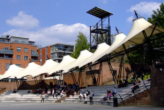
Tiered seating in the Events Arena
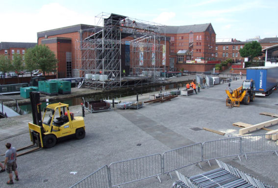
A giant television screen being erected in the events area for the 2010 World Cup
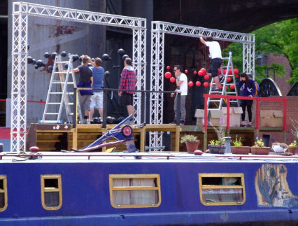
Technicians preparing for filming part of the Black or Red quiz show in 2011
Potato and Giant’s Wharves
Remains of Brindley's Cloverleaf Weir on Potato Wharf
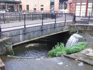
Off Giant’s Wharf is another wharf known as Potato Wharf (a clue to what was unloaded here). Half-way along it is an overflow weir that takes excess water from the canal and drains it into the River Medlock (still in its tunnel). This weir was originally known as the Cloverleaf Weir due to its shape. It was originally much larger than today but, over the years, it has been reduced in size to what you can see today. This weir and its companion close to Cornbrook Bridge were the first of Brindley’s Circular Weirs, predating those found on the Staffordshire and Worcestershire Canal.
The other side of the weir can be seen on Giant's Wharf
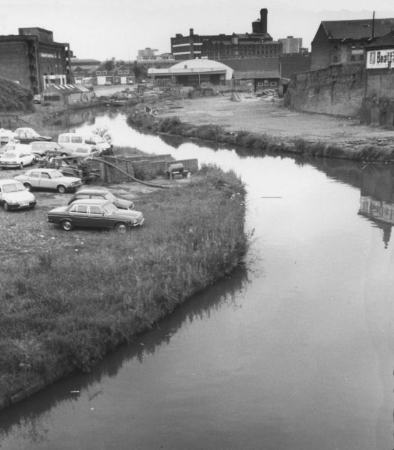
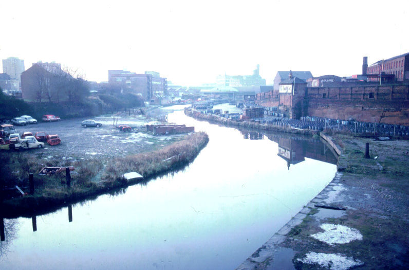
River Medlock
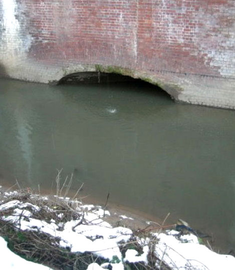
The River Medlock emerging from the tunnel
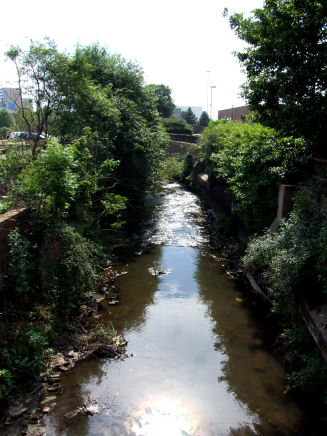
The River Medlock winding its way to the River Irwell at Hulme Lock
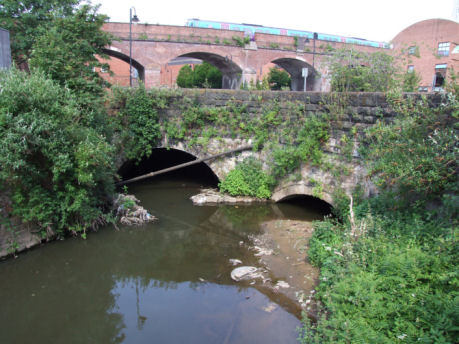
Over the road at the end of Potato Wharf is a wall and if you look over this wall the River Medlock can be seen emerging from its tunnel. From here it runs through an industrial estate to where it joins the River Irwell adjacent to the disused Hulme Lock which. Hulme Lock was not the original connection with the River Irwell which was "The Gut". Hulme Lock was replaced in 1996 with the construction of Pomona Lock a short distance downstream.
or select another book below...
Updated 05-09-2016